
by Panedia Team | Jan 23, 2011 | Virtual Tours
The Sunshine Coast is an urban area in South East Queensland, north of the state capital of Brisbane on the Pacific Ocean coastline.

by Aaron Spence | Jan 13, 2011 | Projects
A series of floods hit Queensland, Australia, beginning in December 2010. The floods forced the evacuation of thousands of people from towns and cities.[2] At least 70 towns and over 200,000 people were affected.[2] Damage initially was estimated at around A$1 billion[3] before it was raised to $2.38 billion.[1] The estimated reduction in Australia’s GDP is about A$30 billion.[4] Three-quarters of the state of Queensland was declared a disaster zone.[5] Communities along the Fitzroy and Burnett Rivers were particularly hard hit, while the Condamine, Ballone and Mary Rivers recorded substantial flooding. An unexpected flash flood caused by a thunder storm raced through Toowoomba’s central business district. Water from the same storm devastated communities in the Lockyer Valley. A few days later thousands of houses in Ipswich and Brisbane were inundated as the Brisbane River rose and Wivenhoe Dam used a considerable proportion of its flood mitigation capacity. Volunteers were quick to offer assistance and sympathy was expressed from afar. A large mobilisation of the Australian Defence Force was activated and a relief fund created. The head of the recovery taskforce was Major General Michael Slater. The Queensland Reconstruction Authority was formed to co-ordinate the rebuilding program beyond the initial taskforce and a Commission of Inquiry established to investigate all matters related to the floods. The 2010–11 floods killed 38 people in Queensland.[6] As of 26 January, an additional nine people were missing.[7] The state’s coal industry was particularly hard hit. The Queensland floods were followed by the 2011 Victorian floods which saw more than fifty communities in western and central Victoria also grapple with significant flooding....

by Aaron Spence | Sep 23, 2009 | Panoramas
With all the noise about the Sydney Dust Storms this morning we here in Queensland were watching with interest… until about lunchtime when the dust storms hit us as well, 1000km (620 miles) north of Sydney. Surfers Paradise Beach – Under Dust. I figured if the dust got so thick I couldn’t see buildings about 300m (1000ft) away I’d head into Surfers Paradise and shoot some virtual tours for posterity. As it turns out we got the pea soup thick dust, so I took the shots. Surfers Paradise Beach – Typical Morning. Here is the full set of 4 virtual tours I shot today. You can also check them out on maps in the virtual tour player. Click the ‘map’ button, on the lower right control...
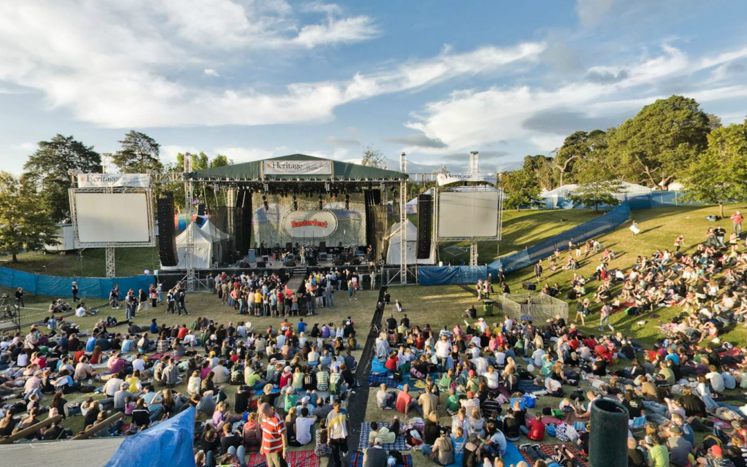
by Aaron Spence | Mar 26, 2008 | News
We hit a big milestone yesterday, 3000 virtual tours. We should have hit it a few months ago, when I finished the panos I shot in the Northern Territory, but I haven’t finished them yet. Instead I was at www.easterfest.com.au on the weekend and shot another 75 panos there, taking our total to just over 3000. So much has been going on over the last couple of months that I can’t begin to explain it all, suffice to say, many new announcements & sites will be forthcoming over the next short while. We also have hundreds more panos in the pipeline, so the 4000 pano milestone will be coming up...

by Sandra Mexa | Jan 29, 0205 | Panoramas
Toowoomba ‘The Garden City’, is a south-east Queensland city famous for its annual Carnival of Flowers, held in Spring. But Autumn is when it really shines in its full splendor. Situated on the edge of the Great Dividing Range, 700 metres above sea level and with lower Autumn and Winter temperatures than the surrounding area, Toowoomba benefits from a quite unique climate. All over the city there is a significant number of deciduous trees from around the world, giving a singular display of autumn yellow, orange and red among the green foliage. Being there at this season is a privilege and watching sunrise at Picnic Point, just on the edge of the Great Dividing Range, is as much astonishing as...